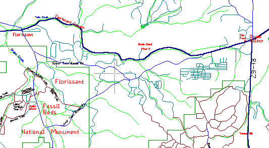
20 Mile Loop 8300-9150 Altitude
The Teller County plateau is a beautiful area of rolling hills and some of the prettiest pastures, forest and rocky hills in region. Near Florissant, the hills turn rocky with numerous monuments and turrets dotting the landscape. This paved road ride rolls through a good sample of all of the above.
Divide village is eight miles west of Woodland Park on Route 24, elevation 9150 feet. Park in the pull-off at the Ute Pass marker just west of the traffic light. Get out the bike and head west on Route 24 - down the long hill toward Florissant. West of Divide, Route 24 is a good bicycling road, wide with light traffic, unlike the traffic jam to the east.
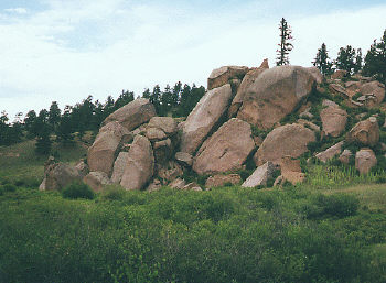
Two miles past Divide is Florissant Canyon and its striking rockpile hillsides. The winding road follows the creek, with house sized boulders stacked on the walls of this beautiful canyon. The most impressive pile is in an amphitheater 5.5 miles from Divide.
Eight miles west of Divide, and 800 feet lower, is Florissant. Turn south on Teller County 1 road and into the Fossil Beds National Monument. The Fossil Beds is a beautiful area of big green pastures, but it's few fossil and historical displays, aren't particularly remarkable. It's main purpose is to keep developers out of the fossil fields.
After looking at the fossil tree stumps, keep riding south to Lower Twin Rocks Road and turn left. This road isn't very wide but it gets almost no traffic. It quietly runs through scenic hills and rocks for six miles before merging with Route 24, just west of Divide. Then it's two more miles back to the car.