9 Mile Loop 8700-9300 Altitude
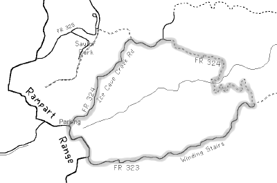
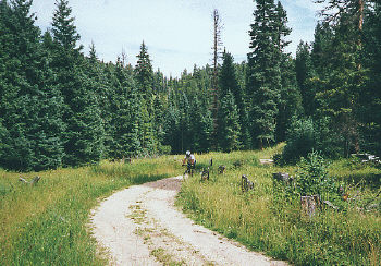
Rampart Range Road runs north from Woodland Park for fifty miles, following the flat top of Rampart Range through forest and rock formations. This flat-top forest is littered with old jeep roads and is one of the region's best kept secrets for mountain bikers. The Ice Cave Creek Road goes through a variety of terrain just ten miles north of Woodland Park. It'll give you a good workout but is non-technical.
Park in the grassy spot at the junction of Rampart Range Road and Ice Cave Creek Road (Forest Road 324). Pull out the bike and ride east on Ice Cave. The first two miles is an easy cruise in the forest but can get confusing because of the side roads.
This part is fairly flat and then it starts a steady downhill that ends at two creek crossings at mile 3.5. This is thick forest with loads of grass and mossy rocks. After the creek is the start of a long climb out of the valley. It's a real struggle at first but then tapers off to merely tough.
In the next two miles there are several spur roads to the left including one that says Winding Stairs, keep to the right and keep climbing. This is now the upper segment of Winding Stairs Road (FR 323). Once out of the valley, the road follows the hilltop with good views to the east and an occasional glimpse of Pikes Peak to the south. After a while, the views are blocked by big trees until you're back on Rampart Range Road. Turn right and it's a half mile back to the car.
To find the start of Ice Cave Creek Road, go east then north on Baldwin at the McDonalds stoplight in southeast Woodland Park. Continue north three miles to the fork next to an old water plant (Loy Creek and Rampart Range). Follow the left fork one mile up a hill and then north on Rampart Range Road (FR 300). Pass the Mount Herman Road, then three more miles to Ice Cave Road FR 324.