2 Mile Trail Out,Back 7400-7600 Altitude
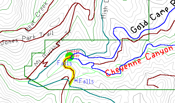
This scenic area at the end of North Cheyenne Canyon has a waterfall right on the road, and a little hiking to another. In the southwest corner of Colorado Springs, drive west into North Cheyenne Canyon. After about two miles, the steep winding road appears to end at the Helen Hunt Falls parking lot. Park there.
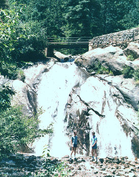
Right on the road is a small nature center, with information about the canyon and its wildlife. Just past the center is the first falls, maybe twenty feet high, with a small foot bridge crossing it. The falls is most impressive after swelled by a rain storm but is barely a trickle most of the year. The trail runs past the falls and over the bridge, which allows you to look straight down the falls.
The trail continues past the bridge and up the split-log stairs imbedded into the loose hillside. After a quarter mile, the trail comes to the second falls. This 'falls' is really a cascade running off the dome shaped hillside. It's also the most dangerous spot in the canyon - hikers walk out onto the slippery dome and then slowly slide away and over the edge.
Past this overlook, the trail unofficially continues up the hill to the collapsed tunnel on Gold Camp Road. This part of the trail isn't for the lazy - it's a steep crawl over a long rock pile. And is even more dangerous on the way back down. If you have the time you can hike the mile and a half on Gold Camp Road to the car - just cross over the tunnel and follow the road.