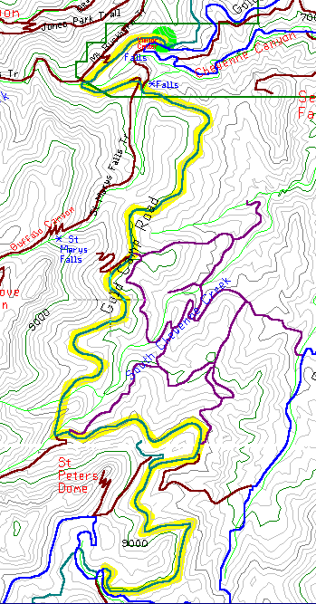
18 Miles Out-Back 7500-9000 Altitude
This road was built in the 1880's for the railroad going to Cripple Creek, but for the last 90 years it's been used for cars. When the first tunnel collapsed it was decided to close this section of road, leaving two good tunnels and nine miles of perfect biking road winding into the mountains.
In the southwest corner of Colorado Springs, drive west into North Cheyenne Canyon. This steep winding road hairpins at Helen Hunt Falls and after a few more bends, you'll find yourself in a big parking area at Gold Camp Road and High Drive.
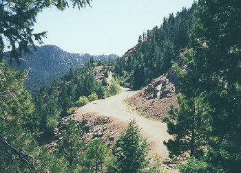
Pull out the bike and head west past the gates that close off the road. The first mile is a big horseshoe curve, which comes back around and stops at the collapsed tunnel. The tunnel is fenced off to keep hikers out, but a trail on your left leads up and over.
Continue south as the road winds in and out of several canyons and near mile five you'll find another tunnel, about 100 yards long and too dark to see the ground below you. A mile later is a third tunnel, only 100 feet long but it curves inside.
After the second tunnel you'll have the whole canyon to yourself - the only sign of life is the antennas on the back side of Cheyenne Mountain and a distant view of Colorado Springs. As the road bends into each side canyon a creek runs out of the forest. The biggest of these is South Cheyenne Creek which later will fall over Seven Falls.
Going in this direction you will be slowly gaining altitude until you reach the merger with Old Stage Road at 9000 feet. To the right of the merge is another tunnel on an abandon section of road. The ride back is an easy downhill that goes by quickly.