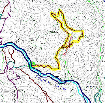
7 Mile Trail 7000-8200 Elevation
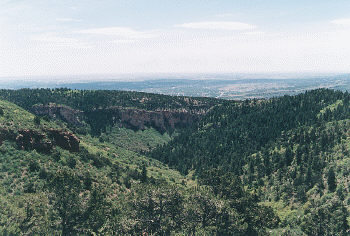
A few miles west of Manitou Springs is one of the region's most popular trails. From the trailhead on Route 24, this trail climbs up the canyon wall and into a scenic side canyon, with lots of good views of the Ute Pass area along the way.
Follow Route 24 west a few miles past Manitou. On the right will be a sizeable parking area, usually full of cars, with a Waldo Canyon sign. Park where you can and start hiking up the stairs on the east side.
The trail starts out fairly steep as it climbs out of Fountain Creek Canyon. The initial views of the canyon and highway are more interesting than you'd expect for a roadway. It then starts a long traverse of the north canyon wall, following the highway east while slowly gaining altitude.
As it climbs, the trail runs in and out of a few canyons, including the rocky Waldo Canyon. It's in this canyon (after two miles) that the trail splits, with both paths being opposite ends of the main 3.5 mile loop. Follow the right fork and the trail starts a zig-zag climb as it heads for the ridge between Waldo and Williams canyons. This ridge is the high point for the trail and naturally has some of the best views.
The trail then starts back into Waldo Canyon and makes a hairpin turn as it crosses Waldo Creek and heads south along the opposite wall. This is the green part of the trails as it follows the shady creek for the next mile. Just before the trail runs out of the trees, it passes the original fork, which means it's two miles back to the car.