6 Mile Trail, Out Back 6800-9200 Elevation
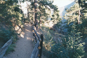
This scenic trail is one of the more popular hikes in the Manitou area, overlooking the foothills and Colorado Springs. The Mount Manitou Trail actually goes to the top of Rocky Mountain. Mount Manitou is a half mile west and doesn't actually have a trail.
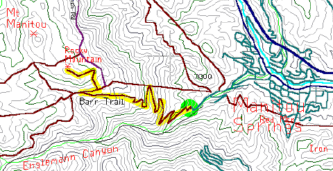
In western Manitou Springs, drive south on Ruxton Avenue for about a half mile. Just before the power plant, is the Barr Trail parking lot, up a short driveway to the right and jammed with cars.
The first two miles of this trail is on the Barr Trail - the most popular trailhead in the region, and now has its own restrooms and an information kiosk. Bicycles are allowed on the trail, but aren't really suitable.
The first mile of this trail is a tiring climb up the eastern side of Mount Manitou, paralleling the old rail bed of the Incline Railway. After about two miles the trail levels off, providing one last view of the mountains to the south, before heading into the trees. The trail has already climbed more than 1500 feet, and most casual hikers won't make it any farther than this. Just into the forest, is the fork to the Manitou Incline, on the right. The sign and the trail are hard to spot so pay attention.
From the fork on the Barr Trail, turn right and follow the upper trail toward the Manitou Incline. It's a half mile to the old Incline where you'll find leftover picnic tables and pretty good views through the trees. Just before this area was a trail going west to Eagles Nest. This is the half mile hike to Rocky Mountain. The trail is steep but the view from the top is spectacular.


